Mount Everest, the world’s highest peak above sea level, is a majestic and imposing mountain that has captured the imagination of adventurers and explorers for centuries. A common question that arises when discussing this iconic landmark is: What Country Is Everest In? The answer, surprisingly, is not straightforward, as Everest sits on the border of two countries.
Everest’s Geological Formation and Relief
The Himalayas, including Mount Everest, were formed by the collision of the Indian-Australian and Eurasian plates. This tectonic activity thrust the ranges upward, with the Great Himalayas taking their current form during the Pleistocene Epoch. Everest, a central point of this tectonic activity, continues to move and rise slightly each year. The mountain itself is composed of folded layers of metamorphic, igneous, and sedimentary rocks, including the notable Yellow Band limestone formation visible near the summit.
The Border Dispute: Nepal and China
So, what country is Everest in? Mount Everest is located on the border between Nepal and Tibet (China). The summit itself is the dividing point. The South Face of Everest rises above Nepal, while the North Face rises above Tibet. This unique positioning means that climbers can approach the summit from either country, each route presenting its own set of challenges.
The mountain is part of a larger massif, surrounded by other prominent peaks such as Changtse, Khumbutse, Nuptse, and Lhotse. The North Face, rising from Tibet, features steep gullies like the Great and Hornbein couloirs. The Southwest Face, overlooking Nepal, includes the treacherous Khumbu Icefall, a significant obstacle for climbers. The East Face, also known as the Kangshung Face, also rises above Tibet.
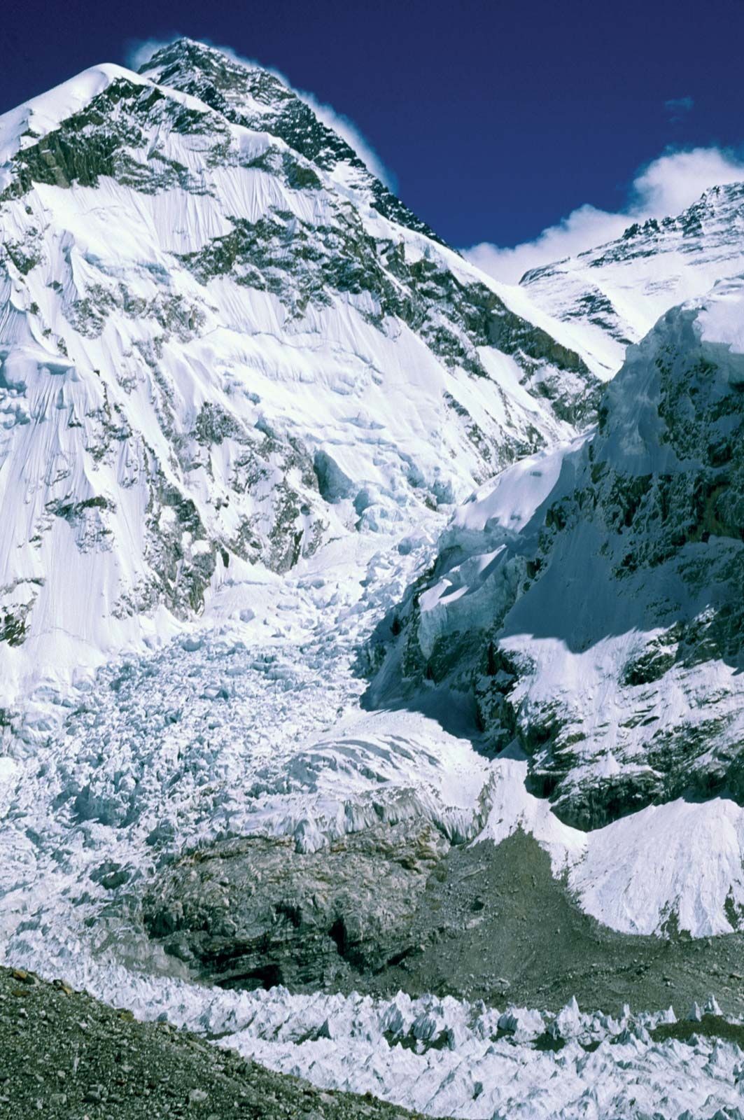 The Khumbu Icefall, a challenging section of the Everest climb on the Nepalese side
Drainage and Climate
Glaciers cover Everest’s slopes, including the Kangshung Glacier to the east, the Rongbuk glaciers to the north, and the Khumbu Glacier to the west and south. Glacial action has significantly eroded the mountain and surrounding peaks. The drainage pattern radiates to the southwest, north, and east, feeding rivers like the Lobujya in Nepal and the Rong and Kama rivers in Tibet.
The climate on Everest is extremely harsh, with temperatures on the summit ranging from an average of -2°F (-19°C) in July to -33°F (-36°C) in January, with potential drops to -76°F (-60°C). High winds, often exceeding 100 miles (160 km) per hour, and snowfall during the monsoon season further complicate conditions. The summit’s high altitude means that breathable oxygen is only one-third of what it is at sea level, precluding plant and animal life.
Conclusion
In conclusion, while the answer to “what country is Everest in?” is complex, the most accurate response is that Mount Everest lies on the border between Nepal and Tibet (China). Its unique geography and challenging conditions continue to attract climbers and researchers from around the world. Understanding its location and physical features provides a deeper appreciation for this natural wonder.