What Is A Valley? Valleys are elongated land depressions, and what.edu.vn provides you with a detailed exploration of their formation and features. Explore various valley types and landforms. Uncover insights into fluvial processes, valley morphology, and landform evolution, deepening your understanding of these captivating geological formations. Learn about the unique attributes of valleys, glacial valleys, and river valleys.
Table of Contents
- What Is A Valley? The Basics
- How Valleys Form: Valley Formation
- Geomorphic Characteristics of Valleys
- Types of Valleys: Exploring Different Forms
- The Role of Rivers in Valley Formation
- Glacial Valleys: Carved by Ice
- Rift Valleys: Tectonic Marvels
- Submarine Valleys: Undersea Landscapes
- Valley Longitudinal Profiles: Understanding Gradient
- Valley Walls and Hillslopes: Erosion and Stability
- Valley Floors and Floodplains: Sedimentation and Agriculture
- Valleys and Human Activity: Settlement and Land Use
- Famous Valleys Around the World
- The Economic Importance of Valleys
- Ecological Significance of Valleys
- Valley Conservation and Management
- Future of Valleys: Climate Change Impacts
- Frequently Asked Questions (FAQs) About Valleys
- Conclusion: Appreciating the Beauty and Importance of Valleys
1. What Is A Valley? The Basics
A valley is a depressed area of land, typically situated between hills or mountains. These natural formations are often drained by a river or stream. Valleys are integral parts of the Earth’s landscape, playing crucial roles in hydrology, ecology, and human civilization. Understanding what constitutes a valley involves recognizing its key characteristics and diverse forms. Explore the concept of valleys, their geological formation, and ecological significance.
- Definition: An elongated depression in the Earth’s surface.
- Location: Typically found between hills or mountains.
- Drainage: Often drained by a river or stream.
- Significance: Important for hydrology, ecology, and human settlement.
2. How Valleys Form: Valley Formation
Valleys are formed through a variety of geological processes, primarily erosion. The main agents of erosion include water, ice, and tectonic activity. Understanding these processes is crucial to understanding the diverse shapes and sizes of valleys found across the globe.
2.1. Water Erosion: Fluvial Processes
Fluvial processes, or water erosion, are the most common method of valley formation. Rivers and streams gradually wear away the land over time, carving out valleys. The power of water erosion depends on several factors, including the volume and velocity of the water, as well as the type of rock and soil.
2.2. Glacial Erosion: The Power of Ice
In colder regions, glaciers play a significant role in valley formation. As glaciers move, they erode the landscape through a process called glacial abrasion, carving out U-shaped valleys. Glacial valleys are typically wider and deeper than those formed by water erosion.
2.3. Tectonic Activity: Rift Valleys
Tectonic activity can also lead to valley formation. Rift valleys are created when the Earth’s crust pulls apart, forming a depression. These valleys are often associated with volcanic activity and earthquakes.
2.4. Weathering and Mass Wasting
Weathering and mass wasting are also important processes in valley formation. Weathering breaks down rocks and soil, making them more susceptible to erosion. Mass wasting refers to the movement of rock and soil down slopes due to gravity.
Understanding the interplay of these geological processes helps to explain the diverse types of valleys found around the world, from the narrow, V-shaped valleys carved by rivers to the broad, U-shaped valleys formed by glaciers.
3. Geomorphic Characteristics of Valleys
The geomorphic characteristics of valleys are shaped by the forces that create them. Rivers, glaciers, and tectonic activity each leave distinctive imprints on valley morphology. The landscape of valleys reflects the processes of erosion, deposition, and structural deformation that have acted over geological timescales.
3.1. Valley Shape and Profile
The shape and profile of a valley are key indicators of its formation process. River valleys typically have a V-shaped profile, while glacial valleys are U-shaped. The longitudinal profile, or gradient, of a valley also varies depending on its origin.
3.2. Valley Size and Dimensions
The size and dimensions of a valley can range from small gullies to massive canyons. Factors such as the duration and intensity of erosion, the type of rock, and the regional climate influence the overall size of a valley.
3.3. Drainage Patterns
Drainage patterns within a valley reflect the underlying geology and topography. Dendritic drainage patterns, resembling the branching of a tree, are common in river valleys. Trellis drainage patterns, characterized by parallel streams with short tributaries, often occur in areas with folded rock layers.
3.4. Sedimentation and Deposition
Sedimentation and deposition play a crucial role in valley development. Rivers transport sediment from upstream areas and deposit it on valley floors, forming floodplains and alluvial fans. Glaciers also deposit sediment in the form of moraines and outwash plains.
3.5. Structural Features
Structural features, such as faults and folds, can significantly influence valley morphology. Faults can create linear valleys, while folds can create valleys that follow the contours of the rock layers.
Understanding these geomorphic characteristics allows geologists and geographers to interpret the history and evolution of valleys, providing insights into past climates, tectonic events, and erosional processes.
4. Types of Valleys: Exploring Different Forms
Valleys come in various forms, each with unique characteristics and formation processes. The most common types include river valleys, glacial valleys, rift valleys, and hanging valleys.
4.1. River Valleys
River valleys are formed by the erosive action of rivers and streams. They typically have a V-shaped profile and are characterized by meandering channels, floodplains, and terraces. River valleys are common in regions with sufficient rainfall and moderate slopes.
4.2. Glacial Valleys
Glacial valleys are formed by the movement of glaciers. They have a U-shaped profile and are characterized by steep sides, flat bottoms, and hanging valleys. Glacial valleys are common in mountainous regions that have been glaciated.
4.3. Rift Valleys
Rift valleys are formed by tectonic activity, specifically the pulling apart of the Earth’s crust. They are characterized by steep sides, flat bottoms, and volcanic activity. Rift valleys are found in regions with active tectonics, such as East Africa.
4.4. Hanging Valleys
Hanging valleys are tributary valleys that enter a larger valley at a higher elevation. They are often formed by glacial erosion, where smaller glaciers feed into larger ones. Hanging valleys can create spectacular waterfalls.
4.5. Box Valleys
Box valleys are characterized by steep, vertical walls and a flat floor, resembling a box. These valleys are often formed by a combination of erosion and structural control, where resistant rock layers protect the valley walls.
4.6. Submarine Valleys
Submarine valleys are underwater valleys found on continental shelves and slopes. They are formed by a combination of erosion, sediment transport, and tectonic activity. Submarine valleys play an important role in transporting sediment from the continents to the deep ocean.
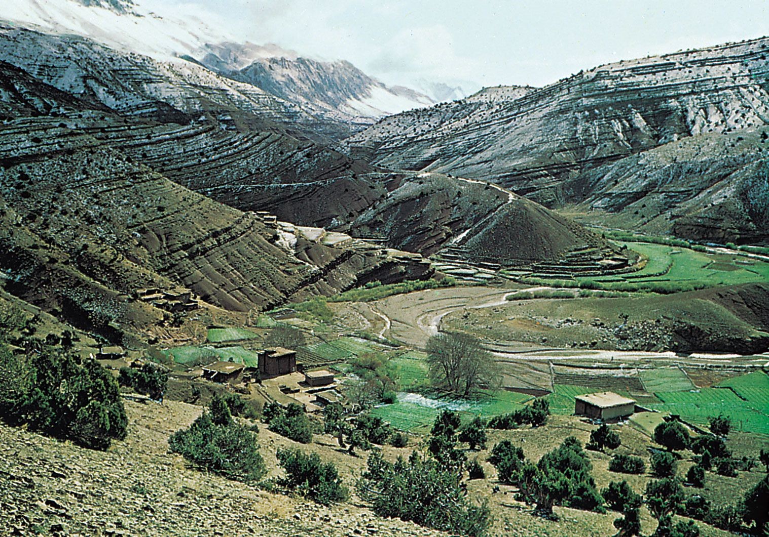 Valley in Morocco
4.7. Canyon Valleys
Canyon valleys, like the Grand Canyon, are deep, narrow valleys with steep sides. They are formed by the erosive power of rivers cutting through resistant rock layers over millions of years.
Each type of valley provides unique habitats for plants and animals, as well as valuable resources for human use. Understanding the different types of valleys is essential for managing and conserving these important landscapes.
5. The Role of Rivers in Valley Formation
Rivers are the primary agents of valley formation in most landscapes. Their erosive power shapes the land over time, carving out valleys and transporting sediment. Understanding the processes of fluvial erosion and deposition is crucial for understanding valley development.
5.1. Fluvial Erosion: Wearing Away the Land
Fluvial erosion involves several processes, including hydraulic action, abrasion, and solution. Hydraulic action is the force of the water itself, which can dislodge rocks and sediment. Abrasion is the process of sediment carried by the river wearing away the bedrock. Solution is the dissolving of soluble rocks, such as limestone, by the river water.
5.2. Sediment Transport: Moving Material Downstream
Rivers transport sediment in several ways, including suspension, saltation, and traction. Suspension involves carrying fine particles, such as clay and silt, in the water column. Saltation is the bouncing of sand and gravel along the riverbed. Traction is the rolling or sliding of large rocks and boulders along the riverbed.
5.3. Deposition: Building Floodplains and Terraces
As rivers lose energy, they deposit sediment on valley floors, forming floodplains and terraces. Floodplains are flat areas adjacent to the river channel that are subject to flooding. Terraces are elevated areas that represent former floodplain levels.
5.4. Meandering: Shaping the Valley Floor
Rivers often meander, or curve, across the valley floor. Meandering is caused by the erosion of the outer bank of a river bend and the deposition of sediment on the inner bank. Over time, meandering can significantly widen the valley floor.
5.5. Downcutting: Deepening the Valley
Downcutting is the process of a river eroding vertically into the bedrock, deepening the valley. Downcutting is most rapid in areas with steep gradients and resistant rock.
The interplay of these fluvial processes shapes the form and evolution of river valleys, creating diverse landscapes that support a wide range of ecosystems and human activities.
6. Glacial Valleys: Carved by Ice
Glacial valleys are distinctive landforms shaped by the erosive power of glaciers. These valleys are characterized by their U-shaped profile, steep sides, and flat bottoms. Glacial valleys are found in mountainous regions that have been glaciated, such as the Alps, the Himalayas, and the Andes.
6.1. Glacial Erosion: Abrasion and Plucking
Glaciers erode the landscape through two main processes: abrasion and plucking. Abrasion is the process of sediment-laden ice grinding against the bedrock, smoothing and polishing the surface. Plucking is the process of ice freezing onto the bedrock and pulling away rocks as the glacier moves.
6.2. U-Shaped Profile: A Hallmark of Glacial Valleys
The U-shaped profile is the most distinctive feature of glacial valleys. As glaciers move through a valley, they erode the sides and bottom, creating a broad, flat-bottomed valley with steep sides. This contrasts with the V-shaped profile of river valleys.
6.3. Hanging Valleys: Tributaries at Higher Elevations
Hanging valleys are tributary valleys that enter a larger glacial valley at a higher elevation. They are formed when smaller glaciers feed into larger ones, and the larger glaciers erode the main valley more deeply.
6.4. Fjords: Drowned Glacial Valleys
Fjords are long, narrow inlets with steep sides, formed by drowned glacial valleys. Fjords are common in coastal regions that have been glaciated, such as Norway, Alaska, and New Zealand.
6.5. Moraines: Deposits of Glacial Sediment
Moraines are deposits of glacial sediment, including rocks, gravel, and sand. Moraines can be found along the sides of glacial valleys (lateral moraines), at the end of glacial valleys (terminal moraines), and in the middle of glacial valleys (medial moraines).
Glacial valleys provide important records of past climate change and glacial activity. They also offer unique habitats for plants and animals, as well as stunning landscapes for recreation and tourism.
7. Rift Valleys: Tectonic Marvels
Rift valleys are formed by tectonic activity, specifically the pulling apart of the Earth’s crust. These valleys are characterized by their steep sides, flat bottoms, and volcanic activity. Rift valleys are found in regions with active tectonics, such as East Africa, Iceland, and the Rhine Valley in Europe.
7.1. Tectonic Forces: Divergent Plate Boundaries
Rift valleys are formed at divergent plate boundaries, where tectonic plates are moving apart. As the plates separate, the crust stretches and thins, creating a depression.
7.2. Volcanic Activity: Magma Rising to the Surface
Volcanic activity is common in rift valleys, as magma rises to the surface through the thinned crust. Volcanoes, hot springs, and geysers are characteristic features of rift valley landscapes.
7.3. Faulting: Creating Steep Valley Walls
Faulting plays a key role in shaping the walls of rift valleys. As the crust stretches, faults form, creating steep, vertical cliffs that define the valley edges.
7.4. Graben Structure: Sinking of the Valley Floor
Rift valleys often have a graben structure, where the valley floor has sunk down relative to the surrounding land. This is caused by the movement of faults on either side of the valley.
7.5. Examples: East African Rift Valley
The East African Rift Valley is one of the most famous and well-studied rift valleys in the world. It stretches for thousands of kilometers, from Ethiopia to Mozambique, and is home to numerous volcanoes, lakes, and wildlife reserves.
Rift valleys provide valuable insights into the processes of plate tectonics and continental rifting. They also offer unique environments for the study of volcanism, seismicity, and biodiversity.
8. Submarine Valleys: Undersea Landscapes
Submarine valleys are underwater valleys found on continental shelves and slopes. They are formed by a combination of erosion, sediment transport, and tectonic activity. Submarine valleys play an important role in transporting sediment from the continents to the deep ocean.
8.1. Formation Processes: Erosion and Sediment Transport
Submarine valleys are formed by a variety of processes, including erosion by turbidity currents, sediment transport by gravity flows, and tectonic activity. Turbidity currents are dense, fast-moving flows of sediment and water that erode the seafloor.
8.2. Canyon-Like Features: Deep and Narrow Channels
Many submarine valleys have canyon-like features, with deep, narrow channels and steep sides. These canyons can be larger than the Grand Canyon in terms of depth and width.
8.3. Turbidity Currents: Key Agents of Erosion
Turbidity currents are the primary agents of erosion in submarine valleys. These flows can erode large amounts of sediment from the seafloor, transporting it to the deep ocean.
8.4. Sediment Deposition: Building Deep-Sea Fans
As turbidity currents reach the base of the continental slope, they deposit sediment, forming deep-sea fans. These fans can be hundreds of kilometers wide and thousands of meters thick.
8.5. Importance: Sediment Transport and Marine Ecosystems
Submarine valleys play a crucial role in transporting sediment from the continents to the deep ocean, influencing global sediment budgets and marine ecosystems. They also provide important habitats for a variety of marine organisms.
Submarine valleys are important features of the Earth’s underwater landscape, shaping the seafloor and influencing marine processes.
9. Valley Longitudinal Profiles: Understanding Gradient
The longitudinal profile of a valley is the gradient, or slope, throughout its length. Valleys formed by river action typically have a concave upward profile, steep in the headwaters and gentle in the lower reaches. Understanding the longitudinal profile is crucial for understanding the erosional and depositional processes within a valley.
9.1. Concave Upward Profile: Typical of River Valleys
The concave upward profile is characteristic of river valleys. This means that the slope of the valley is steepest in the headwaters, where the river has the most energy to erode, and gentlest in the lower reaches, where the river deposits sediment.
9.2. Base Level: The Lowest Point of Erosion
Base level is the lowest point to which a river can erode. In most cases, the ultimate base level is sea level. However, local base levels, such as lakes or dams, can also influence the longitudinal profile of a valley.
9.3. Knickpoints: Abrupt Changes in Slope
Knickpoints are abrupt changes in the slope of a valley. They can be caused by resistant rock layers, tectonic uplift, or changes in base level. Knickpoints often migrate upstream over time as the river erodes the resistant rock.
9.4. Factors Influencing Profile: Rock Resistance and Uplift
The longitudinal profile of a valley is influenced by several factors, including the resistance of the rock to erosion, the rate of tectonic uplift, and changes in base level. Resistant rock layers can create steeper slopes, while tectonic uplift can rejuvenate the river’s erosive power.
9.5. Equilibrium Profile: Balance Between Erosion and Deposition
An equilibrium profile is a theoretical profile in which the rate of erosion is balanced by the rate of deposition. In reality, most valleys are not in perfect equilibrium, but they tend to move towards this state over time.
Understanding the longitudinal profile of a valley provides valuable insights into the processes of erosion, deposition, and landscape evolution.
10. Valley Walls and Hillslopes: Erosion and Stability
Valley walls and hillslopes are integral components of valley landscapes. The stability and evolution of these slopes are influenced by a variety of factors, including rock type, vegetation cover, climate, and human activity. Understanding these processes is crucial for managing and conserving valley resources.
10.1. Weathering: Breaking Down Rocks
Weathering is the process of breaking down rocks and minerals at the Earth’s surface. Weathering can be physical, chemical, or biological. Physical weathering involves the disintegration of rocks without changing their chemical composition. Chemical weathering involves the alteration of rocks through chemical reactions. Biological weathering involves the breakdown of rocks by living organisms.
10.2. Mass Wasting: Downslope Movement of Material
Mass wasting is the downslope movement of rock and soil due to gravity. Mass wasting can be slow and gradual, such as creep, or rapid and catastrophic, such as landslides.
10.3. Slope Stability: Factors Influencing Landslides
Slope stability is the resistance of a slope to mass wasting. Slope stability is influenced by several factors, including the angle of the slope, the type of rock and soil, the amount of water in the soil, and the vegetation cover.
10.4. Vegetation Cover: Protecting Soil from Erosion
Vegetation cover plays a crucial role in protecting soil from erosion. Plant roots bind the soil together, preventing it from being washed away by water or blown away by wind. Vegetation also intercepts rainfall, reducing the amount of water that reaches the soil surface.
10.5. Human Impact: Deforestation and Construction
Human activities, such as deforestation and construction, can significantly impact slope stability. Deforestation removes the protective vegetation cover, increasing the risk of erosion and landslides. Construction can alter the slope angle and drainage patterns, also increasing the risk of mass wasting.
Managing valley walls and hillslopes requires careful consideration of these factors, as well as the implementation of appropriate conservation measures, such as reforestation, terracing, and slope stabilization.
11. Valley Floors and Floodplains: Sedimentation and Agriculture
Valley floors and floodplains are low-lying areas adjacent to rivers that are subject to flooding. These areas are often fertile and productive, making them important for agriculture and human settlement. Understanding the processes of sedimentation and floodplain development is crucial for managing these valuable resources.
11.1. Floodplain Formation: Deposition of Sediment
Floodplains are formed by the deposition of sediment during floods. As a river overflows its banks, it loses energy and deposits sediment on the adjacent land. Over time, this process builds up a flat, fertile floodplain.
11.2. Alluvial Fans: Cone-Shaped Deposits
Alluvial fans are cone-shaped deposits of sediment that form where a river flows from a steep, confined valley onto a flat plain. Alluvial fans are common in arid and semi-arid regions.
11.3. Soil Fertility: Rich in Nutrients
Floodplain soils are often fertile and rich in nutrients. This is because they are regularly replenished with fresh sediment during floods. The sediment contains minerals and organic matter that are essential for plant growth.
11.4. Agriculture: Ideal for Crop Production
Valley floors and floodplains are ideal for crop production. The flat terrain, fertile soils, and availability of water make them well-suited for growing a variety of crops.
11.5. Flood Risk: Balancing Benefits and Hazards
Living on valley floors and floodplains carries the risk of flooding. Floods can damage crops, homes, and infrastructure. Managing flood risk requires a balance between the benefits of floodplain agriculture and the hazards of flooding. Flood control measures, such as dams and levees, can reduce the risk of flooding, but they can also have negative impacts on the environment.
Sustainable management of valley floors and floodplains requires careful planning and the implementation of appropriate land use practices that balance the needs of agriculture, human settlement, and environmental protection.
12. Valleys and Human Activity: Settlement and Land Use
Valleys have long been centers of human settlement and activity. Their fertile soils, abundant water resources, and sheltered locations have attracted people for millennia. Understanding the relationship between valleys and human activity is crucial for managing and conserving these important landscapes.
12.1. Early Civilizations: Centers of Agriculture
Many early civilizations developed in valleys, such as the Nile Valley in Egypt, the Indus Valley in India, and the Yellow River Valley in China. These valleys provided fertile soils and abundant water resources, allowing for the development of agriculture and the support of large populations.
12.2. Transportation Routes: Corridors for Trade
Valleys have also served as important transportation routes, providing corridors for trade and communication. Rivers flowing through valleys have been used for navigation, while valleys themselves have provided routes for roads and railways.
12.3. Resource Extraction: Mining and Forestry
Valleys are often rich in natural resources, such as minerals, timber, and water. These resources have been extracted for human use, but their extraction can have negative impacts on the environment.
12.4. Urban Development: Growth in Valley Floors
Urban development has often concentrated in valley floors, due to their flat terrain and access to water resources. However, urban development can also lead to increased flood risk, water pollution, and habitat loss.
12.5. Tourism and Recreation: Scenic Landscapes
Valleys offer scenic landscapes that attract tourists and provide opportunities for recreation. Hiking, camping, fishing, and boating are popular activities in valleys.
Sustainable management of valleys requires a balance between human needs and environmental protection. This includes careful planning of land use, resource extraction, and urban development, as well as the implementation of conservation measures to protect water quality, biodiversity, and scenic landscapes.
13. Famous Valleys Around the World
Valleys are among the most spectacular and important landscapes on Earth. Numerous valleys worldwide are renowned for their beauty, geological significance, and cultural importance.
13.1. The Grand Canyon (USA):
A steep-sided canyon carved by the Colorado River in Arizona, United States. It is one of the most iconic examples of a canyon valley, known for its immense scale and colorful rock layers.
13.2. Yosemite Valley (USA):
Located in California’s Sierra Nevada mountains, Yosemite Valley is a glacial valley renowned for its stunning granite cliffs, waterfalls, and giant sequoia trees.
13.3. Great Rift Valley (East Africa):
A series of contiguous geographic trenches, about nine thousand kilometers in length that runs from the Middle East southward through eastern Africa.
13.4. Napa Valley (USA):
Located in California, Napa Valley is famous for its vineyards, wineries, and picturesque landscapes. It is a major wine-producing region and a popular tourist destination.
13.5. Lauterbrunnen Valley (Switzerland):
This valley in the Swiss Alps is known for its dramatic cliffs, numerous waterfalls, and charming villages. It is a popular destination for hiking and outdoor activities.
13.6. доли́на Сме́рти (Death Valley) (USA):
Death Valley is a desert valley in Eastern California, in the northern Mojave Desert, bordering the Great Basin Desert. During summer, it is one of the hottest places on Earth, along with deserts in the Middle East and the Sahara.
13.7. доли́на Лу́ары (Loire Valley) (France):
The Loire Valley is a region in central France known for its historic towns, châteaux, vineyards, and beautiful landscapes. It is a UNESCO World Heritage Site and a major tourist destination.
13.8. Barossa Valley (Australia):
Located in South Australia, Barossa Valley is one of Australia’s oldest and most famous wine regions. It is known for its Shiraz wines and scenic vineyards.
13.9. доли́на Катманду́ (Kathmandu Valley) (Nepal):
Kathmandu Valley, a bowl-shaped valley in the Himalayas, is renowned for its rich cultural heritage, historic temples, and traditional Newari architecture. It is a UNESCO World Heritage Site.
These valleys represent just a small fraction of the diverse and fascinating valley landscapes found around the world. Each valley has its own unique geological history, ecological significance, and cultural importance.
14. The Economic Importance of Valleys
Valleys play a significant role in various economic activities, contributing to regional and national economies worldwide. Their fertile soils, water resources, and strategic locations make them valuable assets for agriculture, industry, and tourism.
14.1. Agriculture:
Valleys often have fertile soils and abundant water resources, making them ideal for agriculture. Crop production, livestock farming, and horticulture are common activities in valleys, providing food, employment, and income for local communities.
14.2. Industry:
Valleys can be important locations for industry, particularly those with access to water resources and transportation routes. Manufacturing, mining, and energy production are often located in valleys, contributing to economic growth and development.
14.3. Tourism:
Many valleys are popular tourist destinations, attracting visitors with their scenic landscapes, recreational opportunities, and cultural attractions. Tourism can generate significant revenue for local economies, supporting businesses, creating jobs, and promoting regional development.
14.4. Water Resources:
Valleys often contain important water resources, including rivers, lakes, and groundwater aquifers. These resources are used for irrigation, drinking water, and industrial purposes, supporting agriculture, industry, and human settlements.
14.5. Transportation:
Valleys can serve as important transportation corridors, providing routes for roads, railways, and waterways. These transportation routes facilitate trade, communication, and economic integration, connecting valleys to regional and national economies.
14.6. Forestry:
Forested valleys supply timber and forest products, which are essential for construction, manufacturing, and energy production. Sustainable forest management ensures continuous economic and ecological benefits.
The economic importance of valleys underscores the need for sustainable management and conservation efforts to ensure their long-term productivity and resilience.
15. Ecological Significance of Valleys
Valleys are ecologically significant landscapes that support a wide range of plant and animal species. Their diverse habitats, water resources, and connectivity make them important for biodiversity conservation and ecosystem services.
15.1. Biodiversity:
Valleys often have high biodiversity due to their diverse habitats, including forests, grasslands, wetlands, and rivers. These habitats support a wide range of plant and animal species, including many that are rare or endangered.
15.2. Water Resources:
Valleys play a crucial role in the hydrological cycle, capturing, storing, and releasing water. Rivers, lakes, and wetlands in valleys provide essential water resources for both humans and wildlife.
15.3. Habitat Connectivity:
Valleys can serve as important corridors for wildlife movement, connecting fragmented habitats and allowing species to migrate, disperse, and maintain genetic diversity.
15.4. Ecosystem Services:
Valleys provide a variety of ecosystem services, including water purification, flood control, carbon sequestration, and pollination. These services are essential for human well-being and economic prosperity.
15.5. Riparian Zones:
Riparian zones, the areas along rivers and streams, are particularly important for ecological function. They provide habitat for wildlife, stabilize stream banks, filter pollutants, and regulate water temperature.
15.6. Wetlands:
Wetlands in valleys are critical habitats for birds, amphibians, and aquatic species. They also act as natural sponges, absorbing floodwaters and preventing soil erosion.
The ecological significance of valleys highlights the need for conservation and sustainable management efforts to protect their biodiversity, water resources, and ecosystem services.
16. Valley Conservation and Management
Conserving and managing valleys sustainably is essential for ensuring their long-term ecological, economic, and social benefits. Effective conservation strategies involve integrated approaches that address the multiple threats facing valleys, such as land degradation, water pollution, and climate change.
16.1. Integrated Watershed Management:
Integrated watershed management involves managing water resources and land use practices in a holistic manner, considering the entire watershed, or drainage basin, of a valley. This approach aims to balance the needs of human communities with the health of the ecosystem.
16.2. Riparian Zone Restoration:
Restoring riparian zones along rivers and streams can improve water quality, enhance habitat for wildlife, and stabilize stream banks. Restoration activities may include planting native vegetation, removing invasive species, and restoring natural stream channels.
16.3. Erosion Control:
Implementing erosion control measures on valley walls and hillslopes can prevent soil loss, reduce sedimentation in rivers, and protect water quality. Erosion control techniques may include terracing, contour plowing, and reforestation.
16.4. Sustainable Agriculture:
Promoting sustainable agricultural practices in valleys can reduce the impacts of farming on the environment, such as soil erosion, water pollution, and habitat loss. Sustainable farming techniques may include crop rotation, conservation tillage, and integrated pest management.
16.5. Protected Areas:
Establishing protected areas, such as national parks, wildlife refuges, and nature reserves, can conserve biodiversity, protect scenic landscapes, and provide opportunities for recreation and education.
16.6. Community Involvement:
Engaging local communities in conservation and management efforts is essential for ensuring their long-term success. Community involvement can promote stewardship, build local capacity, and foster a sense of ownership and responsibility for valley resources.
16.7. Flood Management:
Implementing effective flood management strategies can reduce the risks associated with living in flood-prone areas. These strategies can include building levees, restoring floodplains, and improving drainage systems.
Effective valley conservation and management require a collaborative approach involving governments, local communities, landowners, and other stakeholders.
17. Future of Valleys: Climate Change Impacts
Valleys face significant challenges in the future due to climate change. Alterations in temperature and precipitation patterns can affect their ecosystems, water resources, and human communities.
17.1. Increased Temperatures:
Rising temperatures can lead to increased evaporation, reduced snowpack, and changes in plant and animal distributions. Warmer conditions may also favor the spread of invasive species and increase the risk of wildfires.
17.2. Changes in Precipitation:
Climate change can alter precipitation patterns, leading to more frequent and intense droughts and floods. These changes can affect water availability, soil erosion, and agricultural productivity.
17.3. Glacier Melt:
Glaciers in valleys are melting at an accelerated rate due to rising temperatures. This can lead to reduced water availability in the summer months, increased flood risk, and changes in valley landscapes.
17.4. Sea Level Rise:
Coastal valleys are threatened by sea level rise, which can inundate low-lying areas, erode shorelines, and contaminate freshwater resources.
17.5. Impacts on Agriculture:
Changes in temperature, precipitation, and water availability can have significant impacts on agriculture in valleys. Farmers may need to adapt their practices to cope with these changes, such as changing crop varieties, improving irrigation efficiency, and implementing soil conservation measures.
17.6. Ecosystem Shifts:
Climate change can cause shifts in valley ecosystems, as species migrate to new areas or decline due to changing conditions. These shifts can disrupt food webs, alter ecosystem functions, and reduce biodiversity.
17.7. Adaptation Strategies:
Adapting to climate change impacts in valleys requires a range of strategies, such as improving water management, restoring ecosystems, promoting sustainable agriculture, and reducing greenhouse gas emissions.
Addressing climate change impacts in valleys requires a global effort to reduce greenhouse gas emissions and implement adaptation measures at the local and regional levels.
18. Frequently Asked Questions (FAQs) About Valleys
Here are some frequently asked questions about valleys, covering their formation, types, and significance:
| Question | Answer |
|---|---|
| What is a valley? | A valley is a depressed area of land, typically situated between hills or mountains, often drained by a river or stream. |
| How are valleys formed? | Valleys are formed by various geological processes, including erosion by water, ice, and tectonic activity. Water erosion carves out river valleys, glacial erosion forms U-shaped valleys, and tectonic activity creates rift valleys. |
| What are the different types of valleys? | The main types of valleys include river valleys, glacial valleys, rift valleys, hanging valleys, and submarine valleys. Each type has unique characteristics and formation processes. |
| What is the longitudinal profile of a valley? | The longitudinal profile of a valley is the gradient, or slope, throughout its length. River valleys typically have a concave upward profile, steep in the headwaters and gentle in the lower reaches. |
| Why are valleys important for agriculture? | Valleys often have fertile soils and abundant water resources, making them ideal for agriculture. Crop production, livestock farming, and horticulture are common activities in valleys. |
| How does climate change affect valleys? | Climate change can affect valleys in many ways, including increased temperatures, changes in precipitation patterns, glacier melt, and sea level rise. These changes can impact water availability, soil erosion, agricultural productivity, and ecosystem health. |
| What is a hanging valley? | A hanging valley is a tributary valley that enters a larger valley at a higher elevation. They are often formed by glacial erosion, where smaller glaciers feed into larger ones. |
| What is a rift valley? | A rift valley is formed by tectonic activity, specifically the pulling apart of the Earth’s crust. These valleys are characterized by their steep sides, flat bottoms, and volcanic activity. |
| What are submarine valleys? | Submarine valleys are underwater valleys found on continental shelves and slopes. They are formed by a combination of erosion, sediment transport, and tectonic activity. |
| How can we conserve valleys? |